

Although he’s been dead for almost 75 years, D.L. McDonald has cost me thousands of dollars.
I was reading Donald Green’s excellent Land of Underground Rain where Green discusses McDonald’s sinking of what many consider the first high capacity well in the Ogallala. Being a visual person, I searched the interwebs for a photo of Mr. McDonald and found the postcard above on Ebay.
I was blown away. There are postcards of water wells?!?!? I bid and bought the postcard above and now own more than 1,100 postcards concerning groundwater in Texas (with a slight smattering of other things).
At the end of this month, I will be attending a conference in Hereford, so I’ve been excited to perhaps see this well or at least the grounds through which it was drilled. This post concerns a blow-by-blow investigation of where this well might be.
The Texas State Historical Association has this to say about ole McDonald:
This report from 1938 by the Texas Board of Water Engineers includes a well (Well 262) owned by D.L. McDonald drilled in 1911:
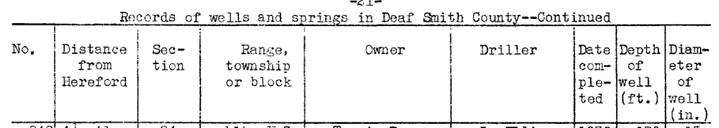


The well has a 26-inch diameter! Although the year is not exactly what it “should” be (1910), this is probably (?) the well. Note that this report shows a number of wells that McDonald drilled for other people.
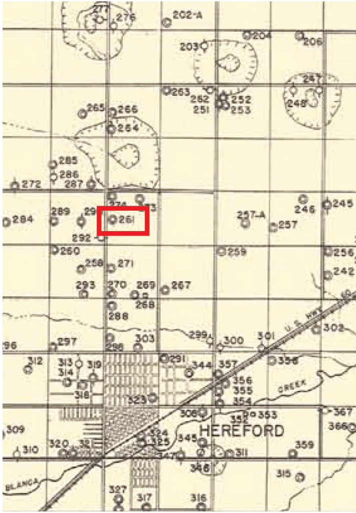
I took a look in the Texas Water Development Board database and BINGO there’s a well owned by D.L. McDonald in the approximate location: 261 shown on the old map above. The reported depth of the well is correct as is the diameter:
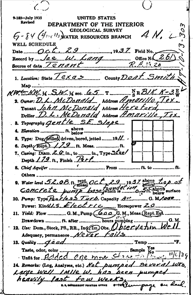
Some water levels from the files in this well:
1915: 46.5 feet below land surface
1937: 51.1 feet
1962: 96.8 feet
Field notes from one visit suggests that there are actually three wells all within 100 yards of each other at the site. So perhaps D.L., after perfecting the art of well drilling, drilled a couple others.
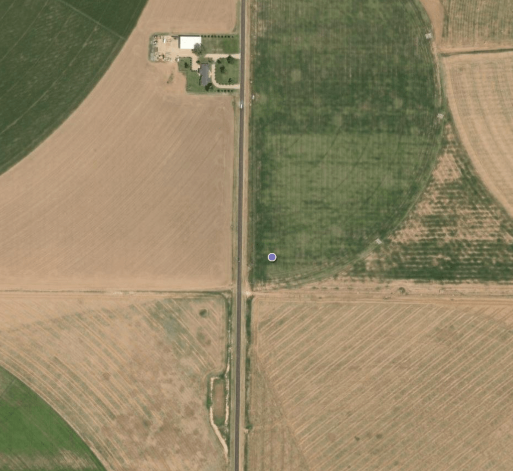
Sadly, the well has almost certainly been destroyed:
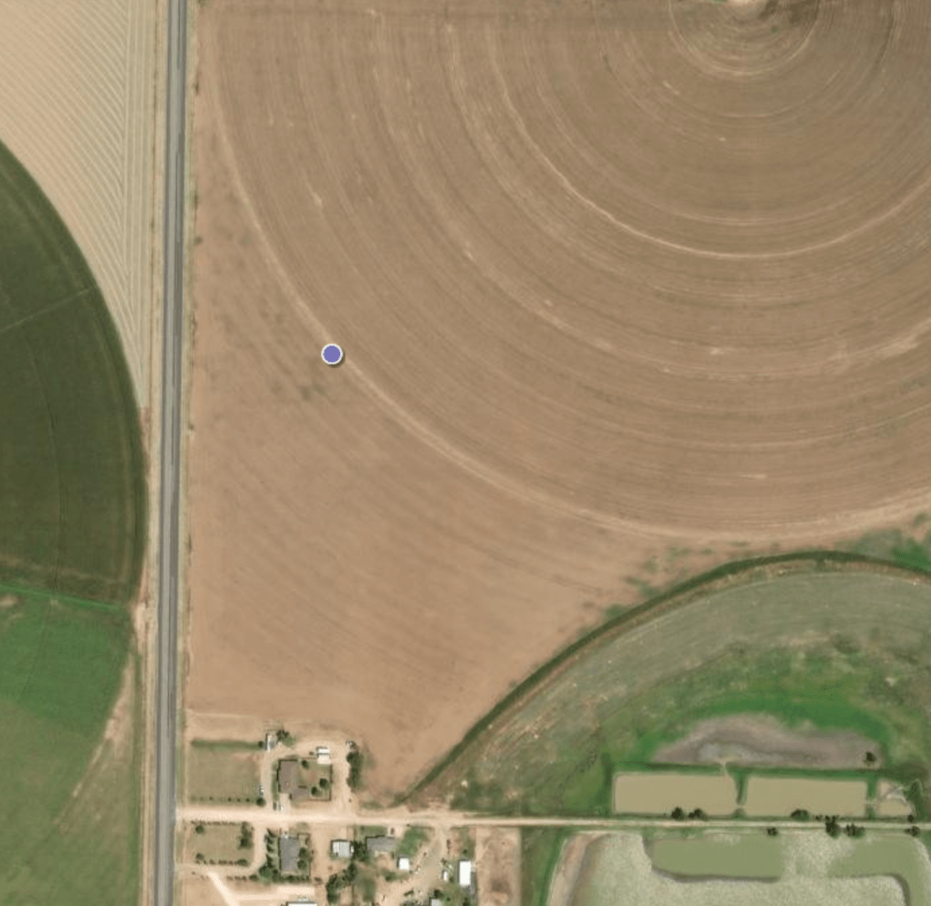
There’s a gnarly spot nearby that may be the original site?
Although that seems too far away from the road.
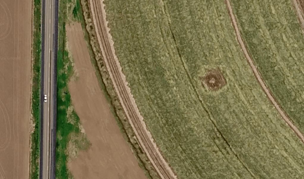
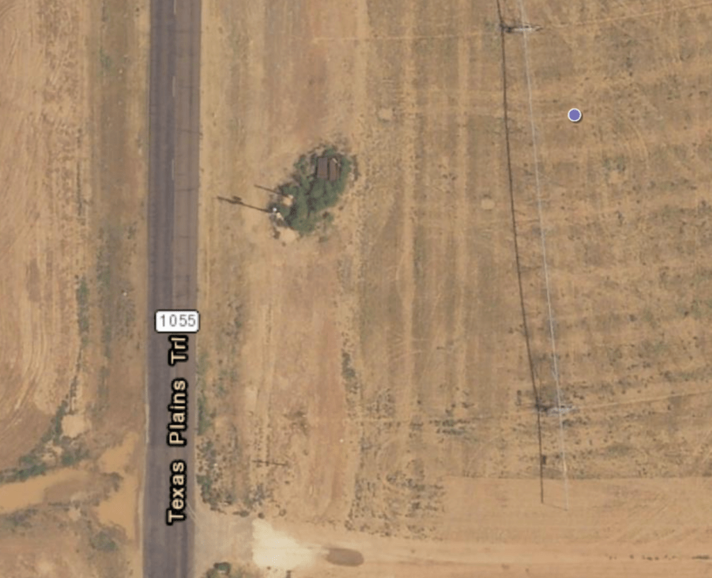
Although 1991 imagery doesn’t seem to show anything (although there might be something right next to the road?):
Or maybe that’s just a bush.
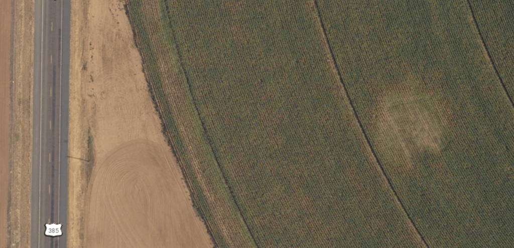
So perhaps this is the well. However, being the yip-yammering geek that I am, I decided to plunge into the archives of the Hereford Brand held by The Portal to Texas History hosted by the University of North Texas to learn more about the well. Boy, was I in for a shocker!
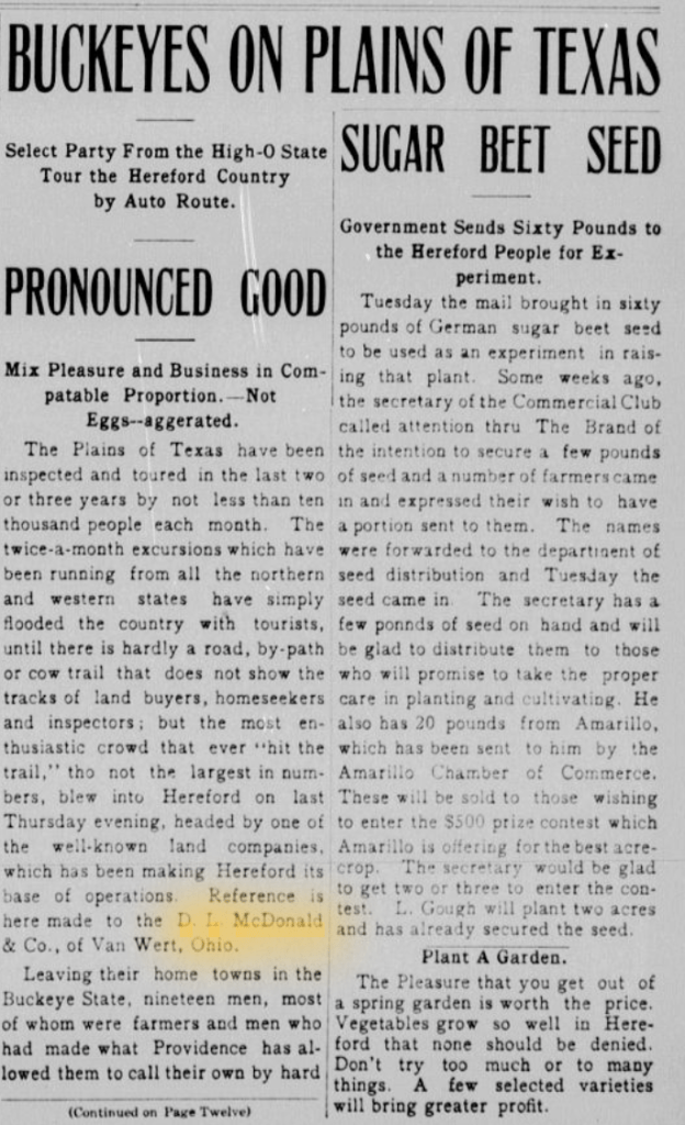
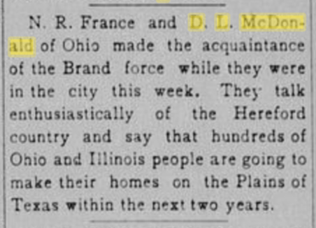
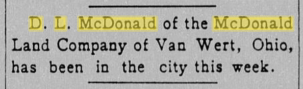
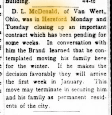
D.L starts arriving in Hereford to check out the scene:

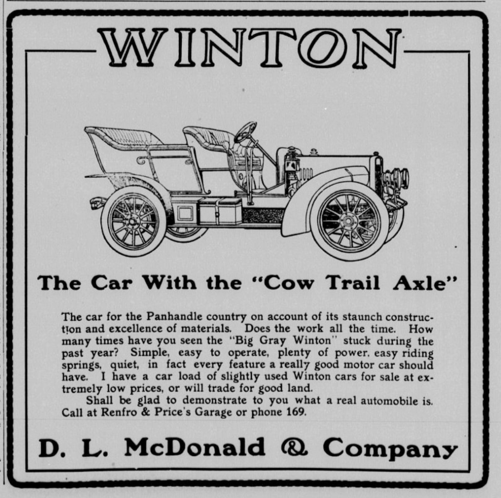
D.L. starts selling Winton automobiles in Hereford:


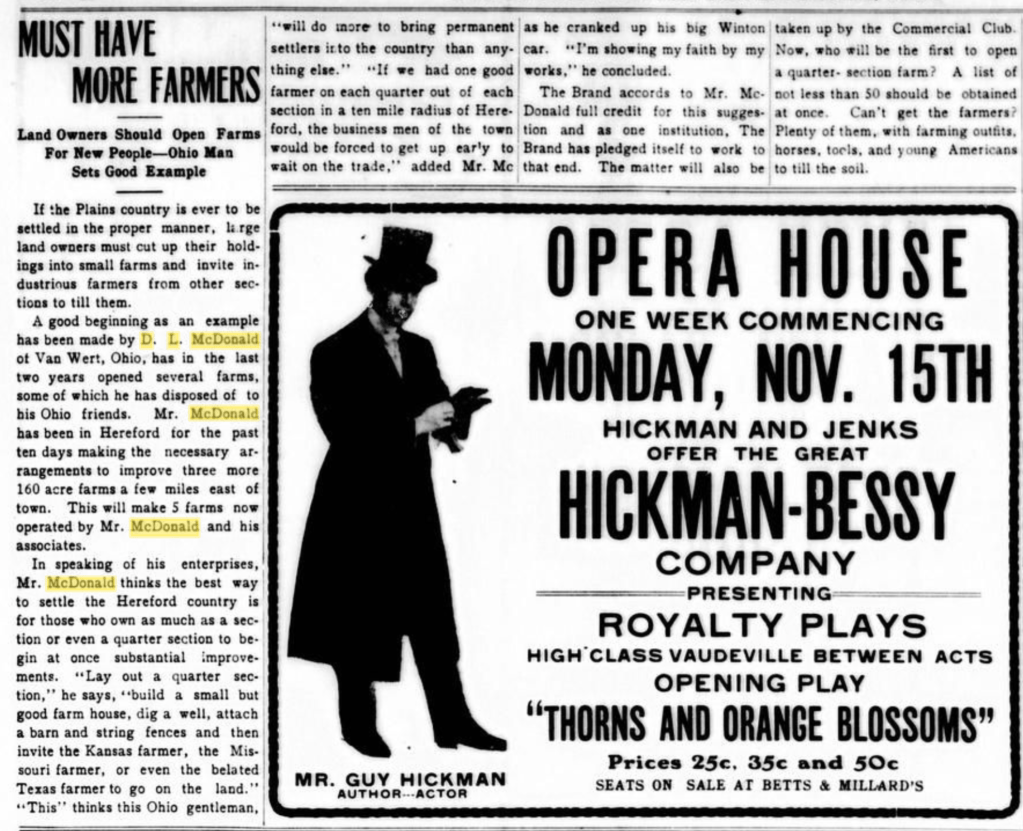
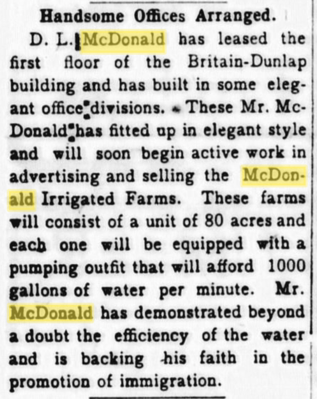
D.L. turns to land marketing by opening farms and then selling them:


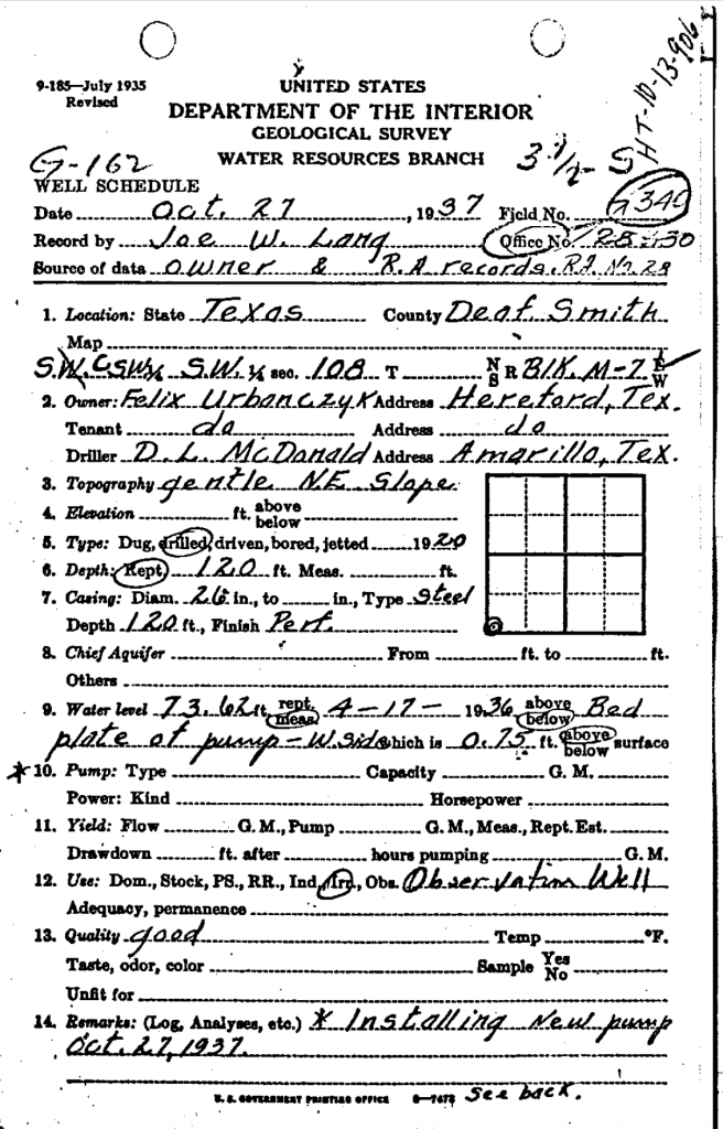
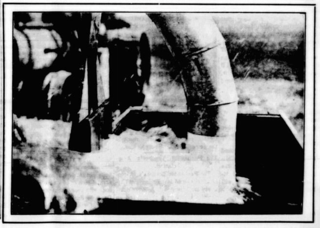
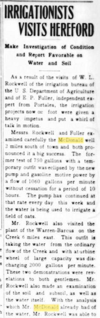
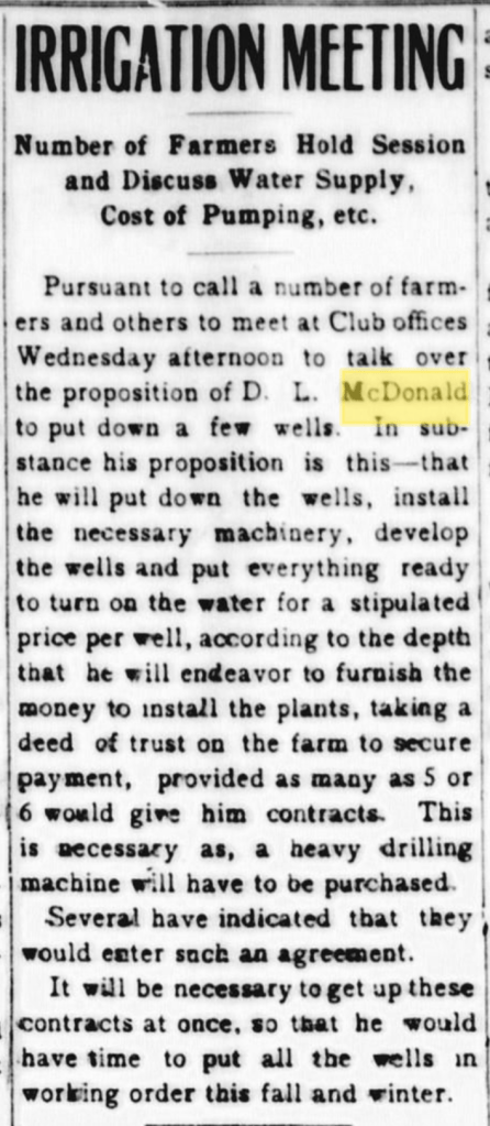
And here we go: The well!
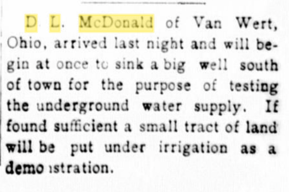
Well, that’s interesting. This describes a well SOUTH of town, not north of town. Did the paper get the direction wrong? It’s certainly possible…
D.L. moves to Hereford:
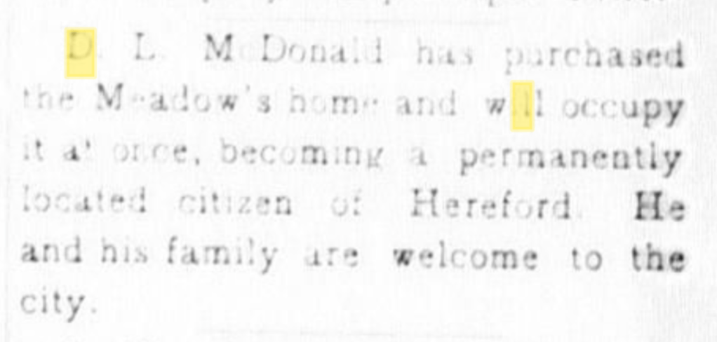
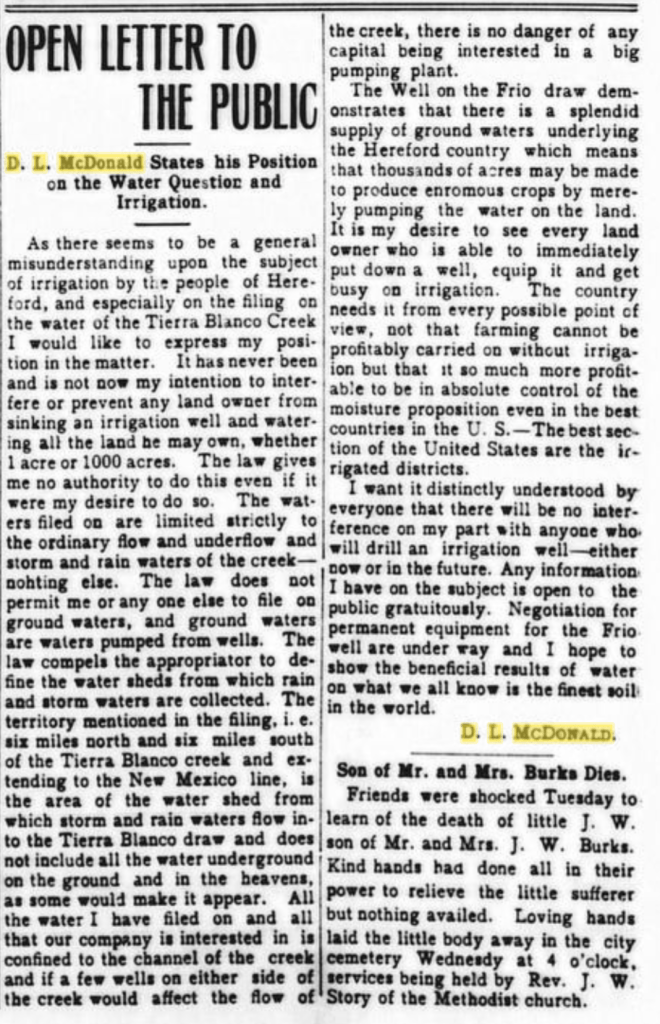
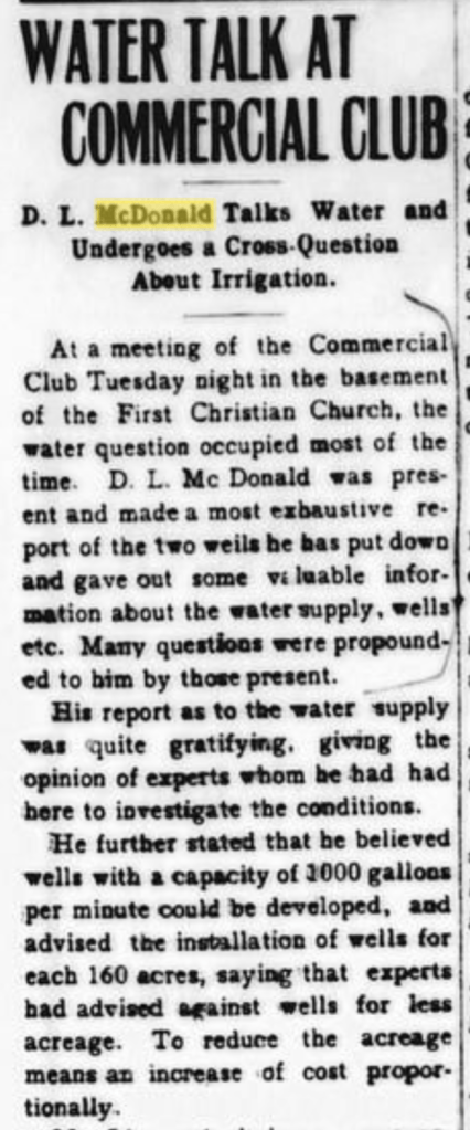
D.L. causes controversy with plans to irrigate with surface water at his northern farm:
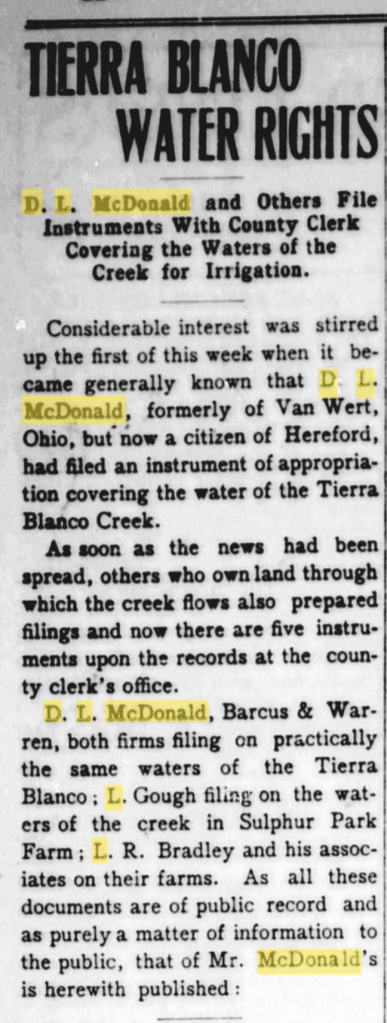
Ole D.L. caused some controversy when he applied for a surface-water right on Tierra Blanco Creek. Many thought he was also laying claim to all the groundwater in the creek’s watershed.
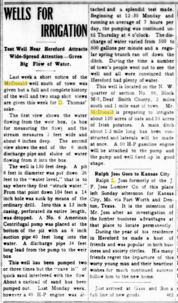
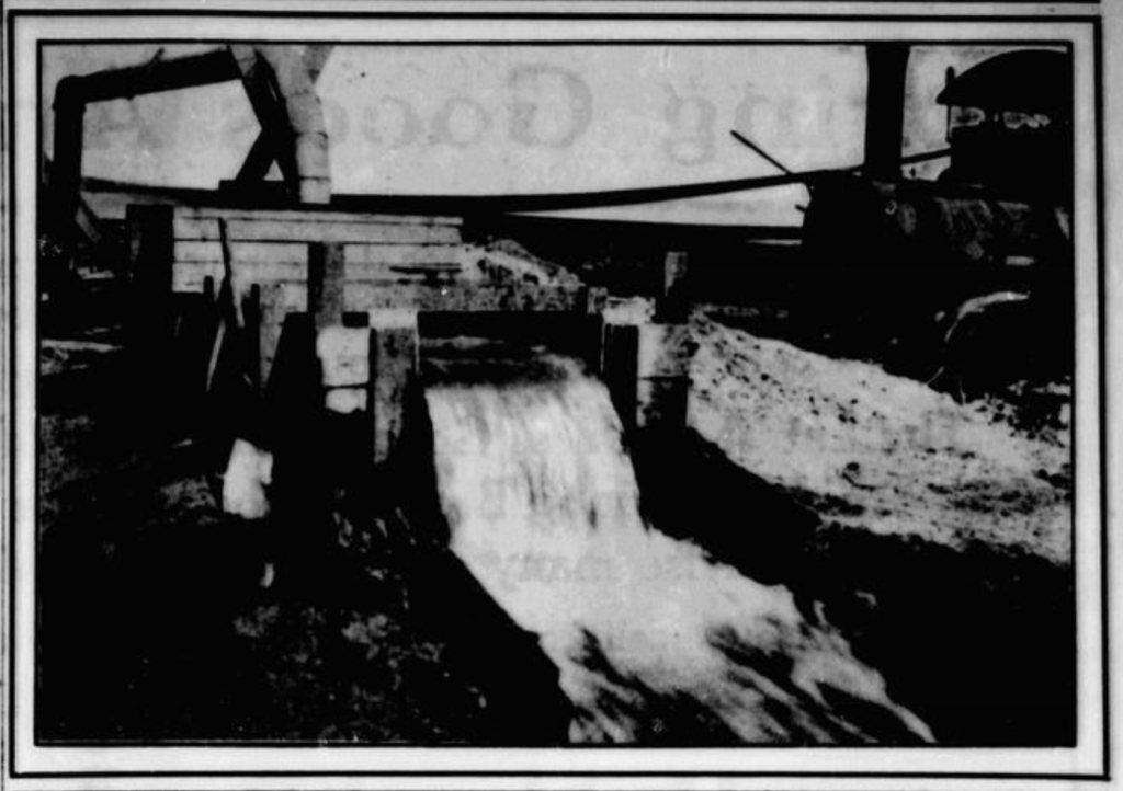
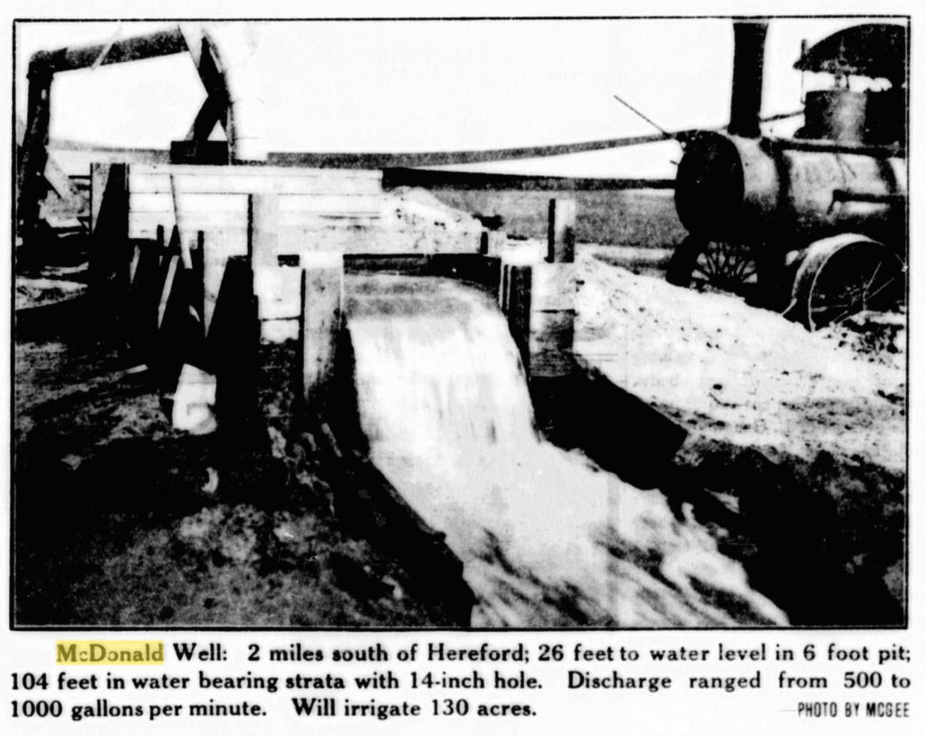
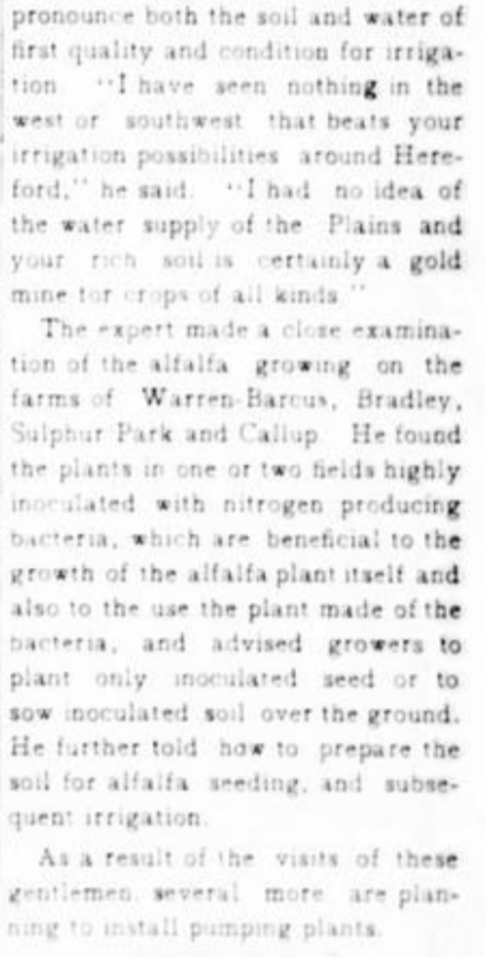
And here comes the well SOUTH of Hereford:
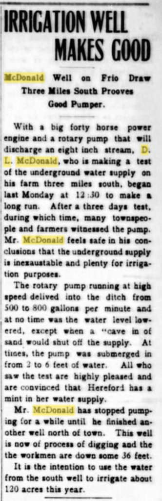
Nope: The paper got it right! THIS is the first big pumper with the north well hot on its heels! Even better, it appears that this well is in the TWDB files (10-13-906) AND STILL EXISTS!!! (maybe…)
How cool is that? And, yes, I plan to visit it (and at least gawk from the road).
Some deets from the Texas Water Development Board:
And from that old report:
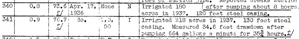
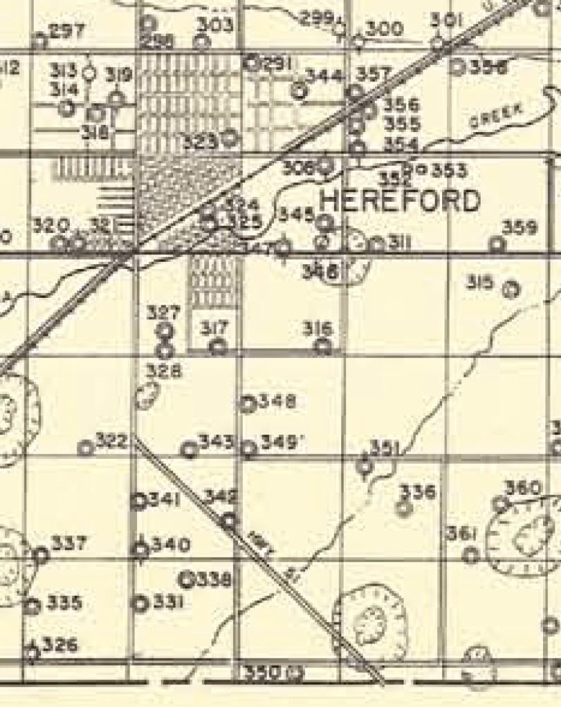
One issue here is that, when surveyed, the drilling date is noted as 1920. Also, 340 is in the TWDB database, but 341 (drilled in 1917) is not. Certainly the diameters (26 inches) are D.L.’s standard.
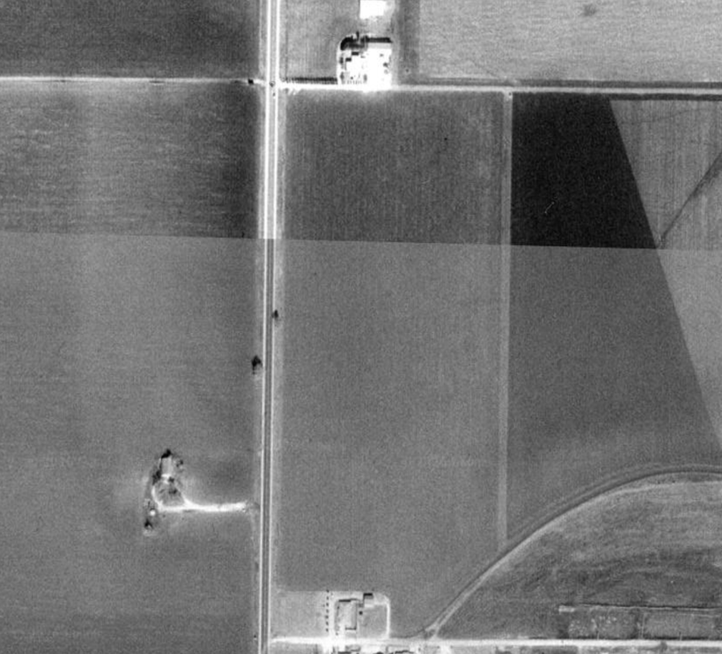
There seems to be something at the location of 341, perhaps a standpipe:
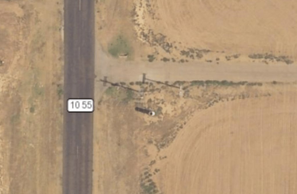
So something else to check out. Down that dirt road is the farmhouse, so I’ll try to stop in and chat with the current (?) owners. Well 341 is three miles south of town, which comports with (most) of reported locations (although the paper sometimes says 2 miles south of town).
I was worried that the owner is listed as Felix Urbanczyk and not McDonald as indicated elsewhere (and below). However, I found the following passage about Felix in The Land and Its People, 1876-1981: Deaf Smith County, Texas at The Portal to Texas History:
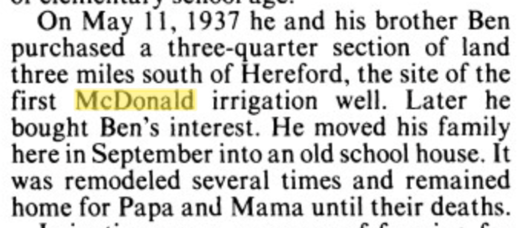
So that directly ties Felix to McDonald (and directly references the “first McDonald irrigation well”).
As far as the date is concerned, perhaps it’s wrong, or perhaps, similar to the northern farm, McDonald drilled multiple wells here and this is the one that stuck (there are mentions below of D.L. having problems with the sand seeping into his first well).
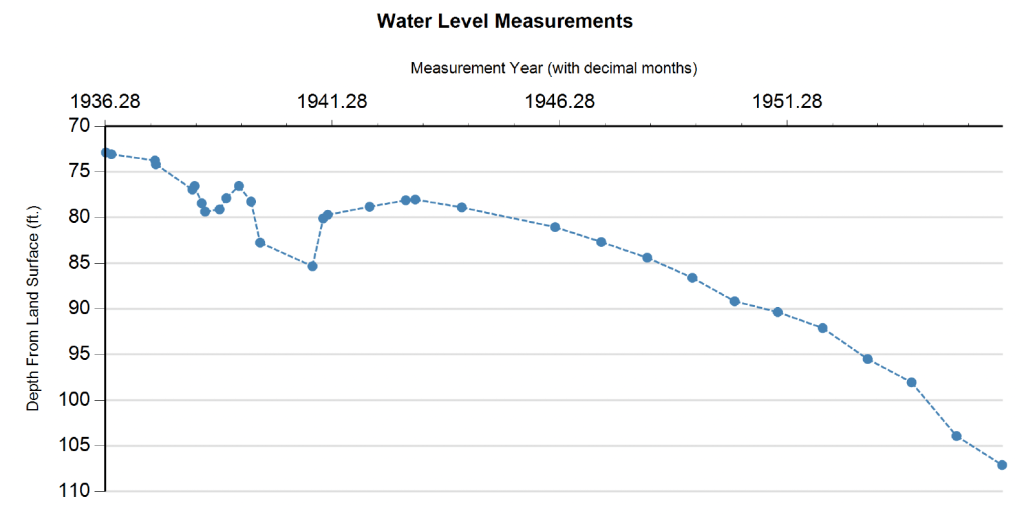
Some water-level measurements showing when things started going to hell in the aquifer as far as pumping unsustainably:
A letter from D.L. McDonald to the public about his efforts to gain surface water rights from a drainage north of town shows that he considered this well to be the first:


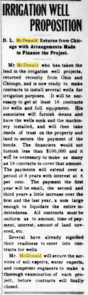
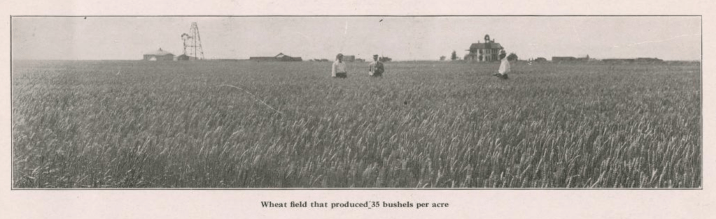
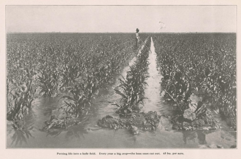
In 1918, D.L. put out a booklet (stored at SMU) hyping the farming and ranching prospects in the county:
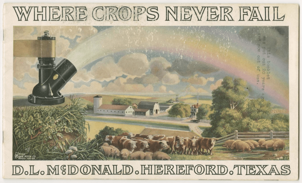
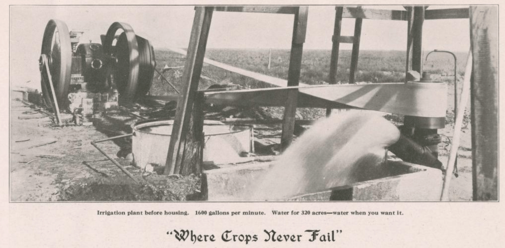
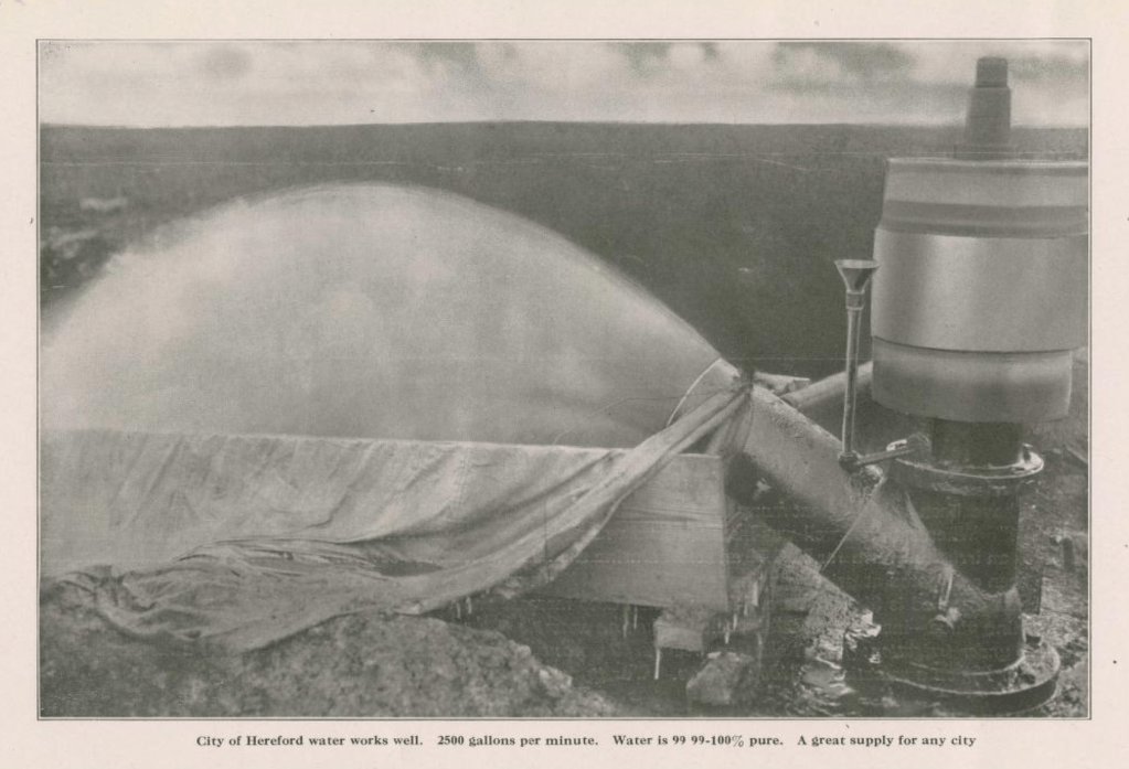
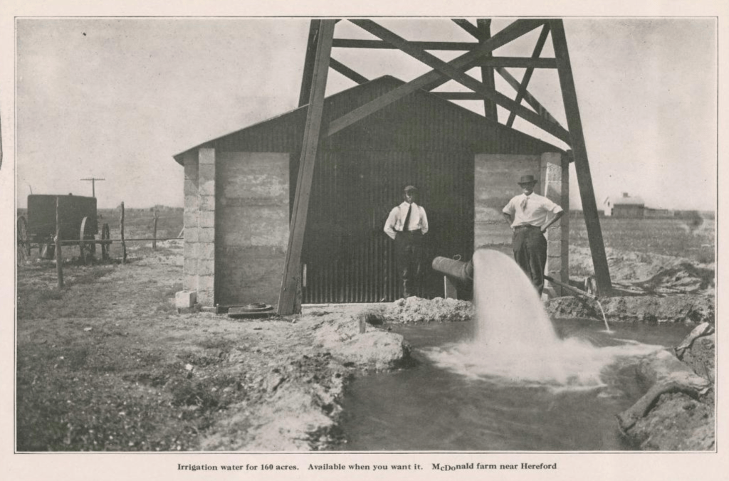
Can’t tell if this image (which was used for the postcard) is for the northern or southern farm (or for a completely different well).
Stay tuned for photos of both sites when I return from my adventure to Hereford later this month!

a splendid supply of water – amazing research Robert!
LikeLike
“….thousands of acres may be made to produce enormous crops by merely pumping the water on the land.” — Ole McDonald, developer. Very telling tale, this.
Carolea Hassard
LikeLike