


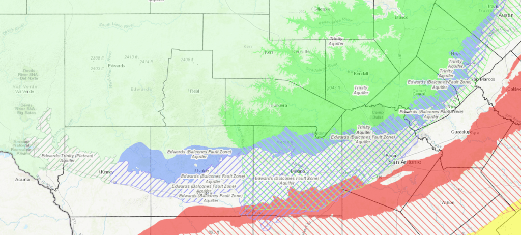
Kinney County includes two state-recognized major aquifers, the Edwards (Balcones Fault Zone) Aquifer and the Edwards-Trinity (Plateau) Aquifer (Figure 1). The lines, the colors, the desired future conditions, and the groundwater availability models suggest that these are two distinct and separate aquifers.
But are they?
The short answer is “No.” The Edwards rocks in the Edwards (Balcones Fault Zone) Aquifer are the same Edwards rocks in the Edwards-Trinity (Plateau) Aquifer. Nothing magical happens when you step across that line in Kinney County. The line that defines the northern part of the Edwards (Balcones Fault Zone) Aquifer in the county is largely arbitrary, defined more by convenience than any hydrogeologic (or geologic) reason.
The western edge of the Edwards (Balcones Fault Zone) Aquifer in Kinney County is based on a presumed groundwater flow divide, but there are several of those in the county, and past maps used different flowlines to define that boundary, sometimes excluding Las Moras Springs or sometimes including Pinto Springs along with Las Moras Springs. Furthermore, a groundwater flow divide is defined by hydraulics, not geology (although the geology influences) and can (and often do) move in karst aquifers in response to changes in recharge and groundwater production.
One awkward result of the current map of the major aquifers in Texas is the exclusion of the Trinity Aquifer underneath the Edwards (Balcones Fault Zone) Aquifer in Kinney County and the vast majority of Uvalde County (figures 2 and 3).
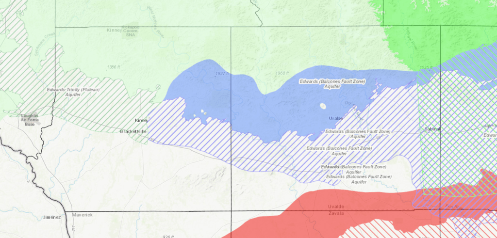
The western “edge” of the Trinity Aquifer underneath the Edwards (Balcones Fault Zone) Aquifer appears in far eastern Uvalde County (Figure 4).
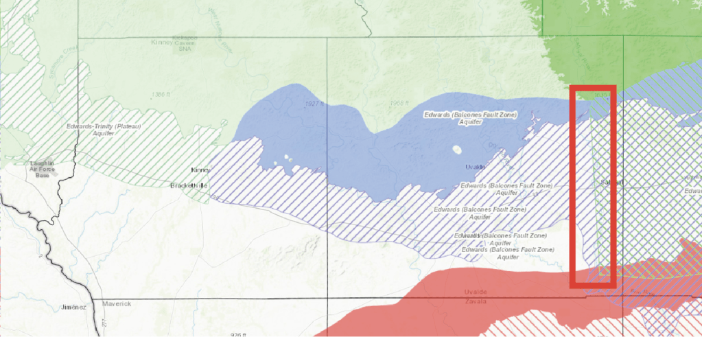
This is an edge of convenience that ties into where the Texas Water Development Board decided to end the Trinity Aquifer in the outcrop (another edge subject to interpretation). This edge follows a presumed flowline into the subsurface. However, there are Trinity rocks underneath the Edwards (Balcones Fault Zone) Aquifer in Kinney and Uvalde counties (Figure 5).
Why was it left out?
It’s like that awkward uncle: no one knows what to do with him around Thanksgiving. Those awkward-uncle Trinity rocks could have been left in and, say, attached to the Edwards-Trinity (Plateau) Aquifer, but then why are the Trinity rocks severed from the Edwards rocks there and not elsewhere? They could be included with the Edwards (Balcones Fault Zone) Aquifer, but then how is that any different than the Edwards-Trinity (Plateau) Aquifer? They could be attached to the Trinity Aquifer, but then they would oddly protrude from the rest of the aquifer and be “disconnected” from its recharge zone. So, in the end, those rocks were not invited to Thanksgiving dinner. Just remember: they are still there.
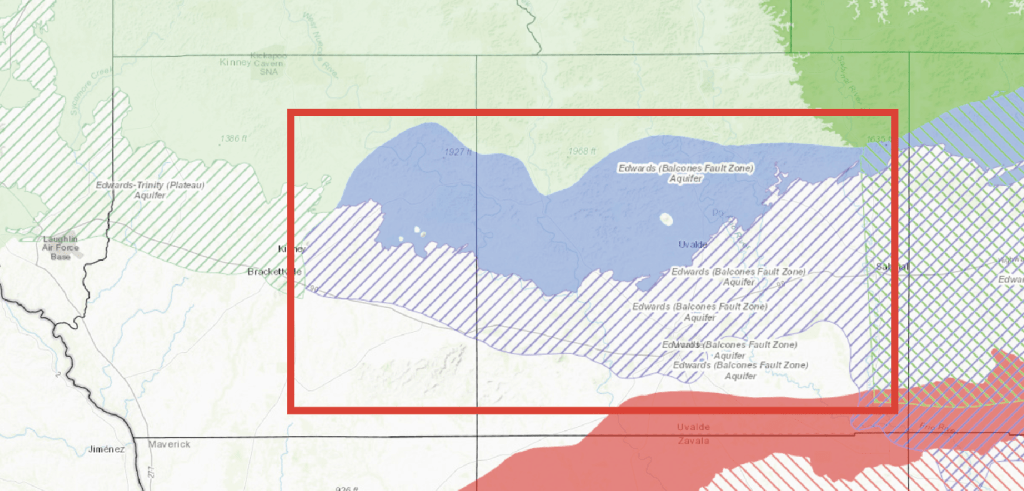
So why is the western boundary for the Edwards (Balcones Fault Zone) Aquifer drawn where it is drawn today? That ties back to how recharge for the Edwards (Balcones Fault Zone) Aquifer is estimated. In short, this analysis includes the Nueces River Basin which includes the West Nueces River Basin which includes Kinney County (Figure 5). Some of the water that recharges the aquifers in the West Nueces River Basin heads southwest to, towards, and beyond Las Moras Springs, and some heads east towards San Antonio. How much heads which way is not known, so Las Moras is included so that the discharge from those springs are accounted for when assessing total recharge to the Edwards (Balcones Fault Zone) Aquifer.
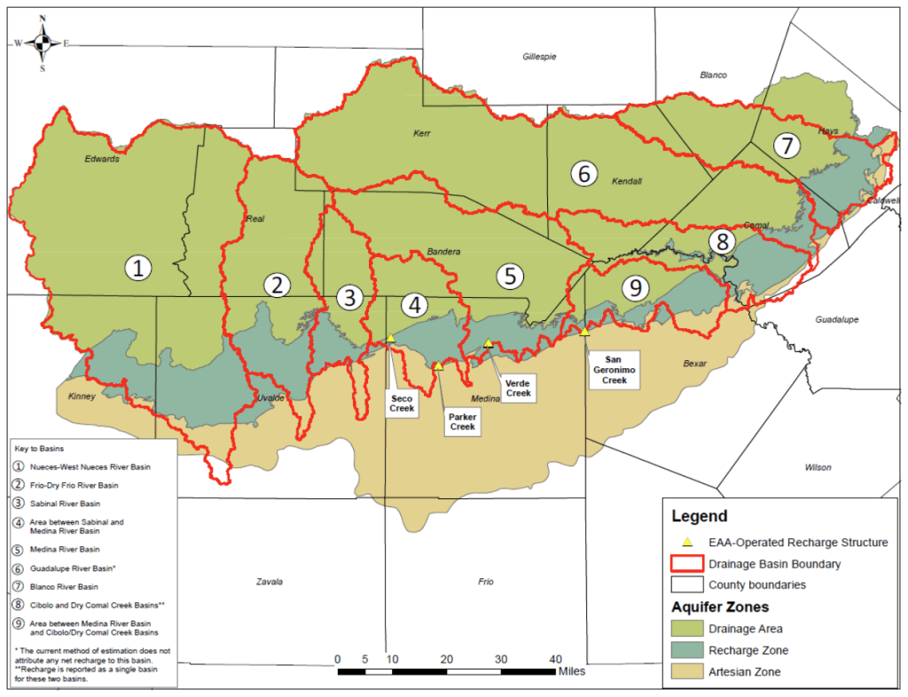
the Edwards (Balcones Fault Zone) Aquifer (from EAA 2020).
Given this logic, it’s unclear why Pinto Springs is not included in the Edwards (Balcones Fault Zone) Aquifer given than some of its flow is likely derived from the West Nueces River Basin.
Interestingly, the recharge assessment for the Edwards (Balcones Fault Zone) Aquifer does not consider cross-formational flow from the Trinity Aquifer (EAA 2020), largely because, although there are estimates (I’ve provided one in the past…), no one knows what exactly it is. Not mentioned is flow from the West Nueces River Basin that flows past the springs in Kinney County and heads towards Del Rio. This is technically not cross-formational flow because no formations are crossed with this flow, but the flow is “cross-aquifer” because it flows from the Edwards (Balcones Fault Zone) Aquifer into the Edwards of the Edwards-Trinity (Plateau) Aquifer.
REFERENCES:
- EAA (Edwards Aquifer Authority), 2020, Recharge in the Edwards Aquifer region: Hydrologic Data Fact Sheets, Edwards Aquifer Authority, 7 p. https://www.edwardsaquifer.org/wp-content/uploads/2022/02/2020-Recharge.pdf
- TWDB (Texas Water Development Board), 2024, Water Data Interactive–Groundwater Data Viewer: accessed November 15, 2024, https://www3.twdb.texas.gov/apps/waterdatainteractive/groundwaterdataviewer

You’re making me squint. Thanks for this. Bill Hutchison has talked about how it’s all connected under there.
LikeLike
This is a nice summary Robert. We frequently draw neat lines to delineate underground features. Those same features were formed in high energy and (probably) violent depositional processes. Without question there are many rocks that wound up in weird spots under these conditions.
LikeLike