
In April 1757, a Spanish contingent of soldiers, settlers, and Franciscan fathers established Presidio San Luis de las Amarillas on the left bank of the spring-fed San Saba near present-day Menard. The fathers built Mission Santa Cruz de San Saba on the opposite bank four miles downstream to avoid frightening the Lipan Apache they hoped to convert to Christianity. The Comanche, convinced their Lipan enemies had allied themselves with the Spaniards, attacked the mission on March 16, 1758, with a coalition of 2,000 Indians, killing 8 people, including the two friars (one of which was beheaded at the altar), and all the livestock. The Spanish government, concerned that the loss of the mission would appear as a weakness to the Comanche and French, kept the presidio in operation until 1768.
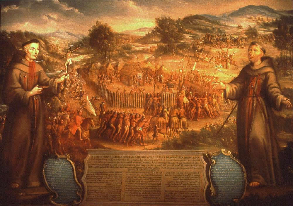 “The Destruction of Mission San Saba in the Province of Texas and the Martyrdom of the Fathers Alonso de Terreros, Joseph Santiesteban” (1765)
Settlement retreated to the presidio where the Spaniards constructed an acequia to irrigate crops along the right bank. Colonel Nathaniel Taylor, in his book The Coming Empire published in 1877, stopped at the ruins of the presidio and remarked that “Here are the crumbling ruins of a mighty edifice of carved stone; and the remains of a net-work of irrigation ditches, extending miles along the river…” (The Colonel, who spends quite a few of his words ogling women across the state, also noticed the hardiness of the women in Menard, noting, in a section titled “The Female Ultima Thulians,” that “None but strong-minded women can be the mothers of strong-minded men. Kitten women are the mothers of kitten men.”)
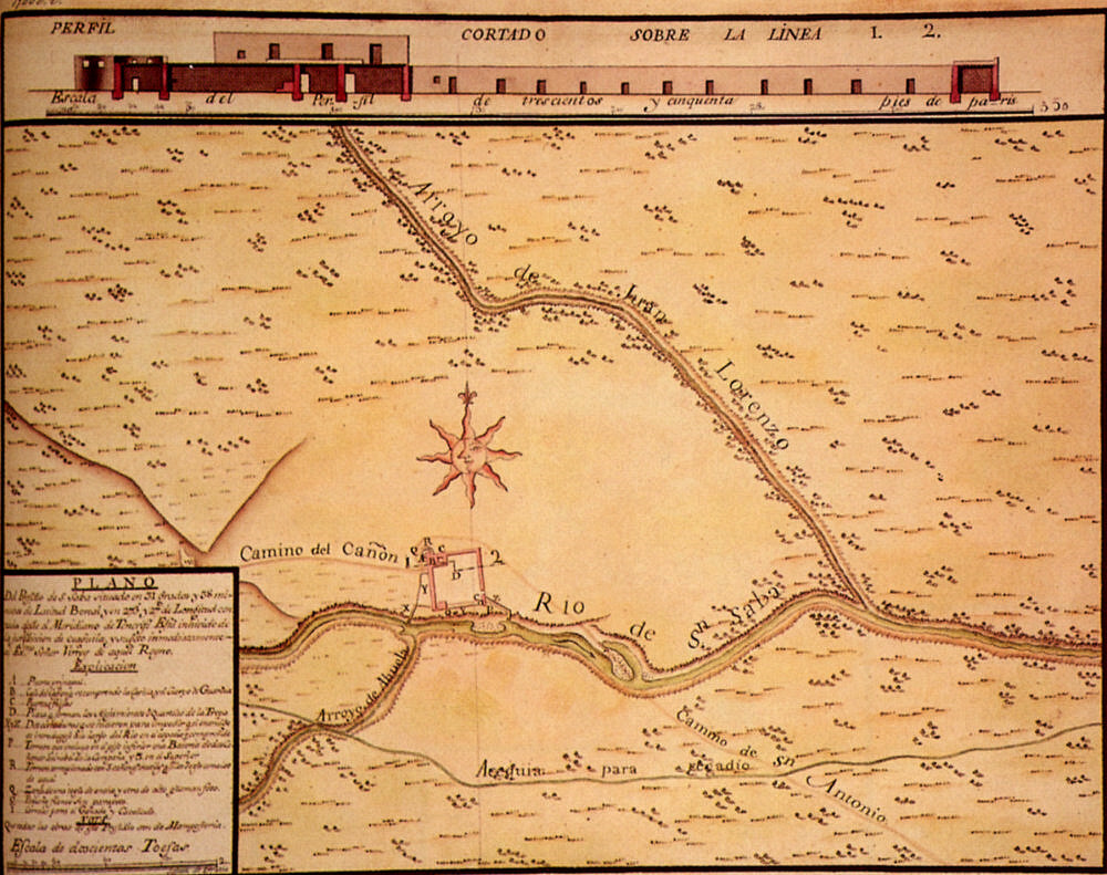 A 1767 map of the presidio showing the local surface=water features and the acequia.
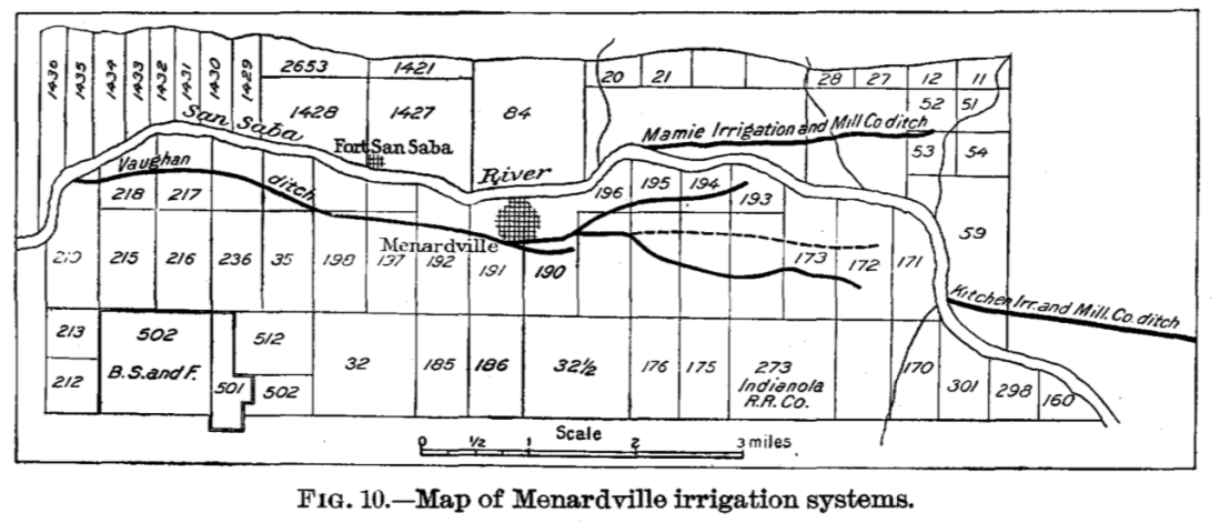
Colonel Taylor had just missed the efforts of William J. Vaughn, who chartered an irrigation company in 1874 that began operation in 1876 with an irrigation canal system that starts five miles upstream of Menard and extends several miles downstream of town. A 1902 USGS publication reports on the “Old Mission ditch” which “can be easily traced to-day” (although I can’t see remnants from satellite imagery to-day…). The USGS report further notes that the dam for this ditch was just upstream of the fort (again, can’t see remnants, perhaps because a newer dam downstream has flooded the channel here). The report also notes that the Old Mission ditch skirted the hills about half a mile upstream of Menardville (the name of Menard at that time). The USGS report further reports on the Vaughn ditch, showing it splitting and petering out east of town:
The local lore holds that the irrigation canal that directs flow through town along Canal Street, called “The Ditch”, is the original acequia. It’s certainly possible (why would Vaughn not use something that was already there?), but Menard was already there when Vaughn built his canal (which explains the not-to-far-from-the-river-straight-shot through town) and why would the Spaniards not hug their canal to the southern hills to maximize land available for irrigation?

The canal is the thin blue line south of the river.
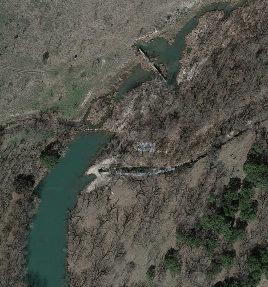 Diversion for the irrigation canal.
So, what does this have to do groundwater? Well, first, baseflow to the San Saba is fed by springs discharging from the Edwards-Trinity Aquifer upstream near Fort McKavett with side trickles along the way. Secondly, due to low flows and a surface-water call, farmers are drilling wells and allegedly pumping water from the underflow of the river.
The surface-water right call is interesting. A “call” is a request by a surface-water right holder to the state (or a watermaster, if one exists) to reduce or cut off junior upstream water rights. In other words, if you hold a water right issued in 1934 and aren’t getting enough water and your neighbor upstream has a right from 1952 (younger, or junior, to your right), your call will likely shut down your neighbor’s use of the water. The other interesting thing is that Texas has something called superior rights. These are riparian rights (if you front the river, you have a right to use the water for livestock and household use) which I’ll venture to say are left-over from the Spanish-era water laws that used to rule the land. A superior right can shut down all upstream rights (except, presumably, other superior rights), including cities, power plants, industries, and irrigators. (There’s also something called a “futile call.” If the state believes that water would still not reach you even if it shuts down all upstream use, then it will not honor your call.)
Decreasing flows in the late 1990s (with the flip of the Atlantic Multi-decadal Oscillation, I might add…) led to the creation of Friends of the San Saba, a collection of downstream landowners who rely on flows for their operations. In 2013, the Friends of San Saba made a formal complaint to TCEQ about the 104 alluvial wells along the river and canal.
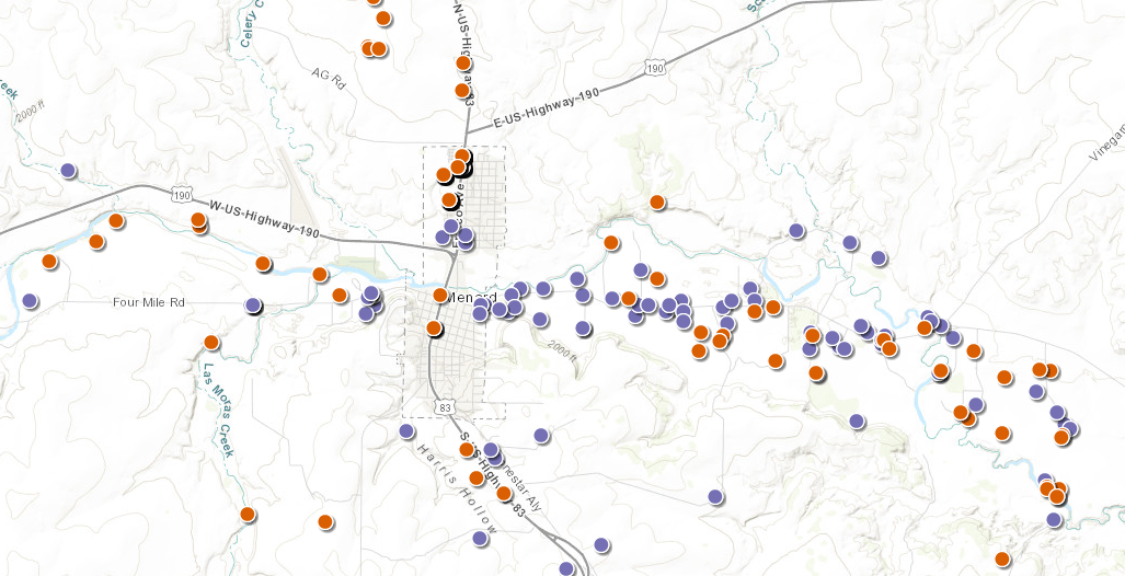 Water wells in TWDB’s Groundwater Data Viewer. The red dots are wells drilled since 2001.
TCEQ determined that at least 8 wells were directly connected to and drawing from the river, thus requiring those water wells to register for surface-water rights and be subject to downstream, more senior calls.
The issues here are complicated and intense (and I’ve probably already said something to piss someone off; note that I am correctable!). The House Natural Resource Committee of the Texas Legislature held an interim committee hearing here in 2018 and has considered legislation to better understand surface water/groundwater interaction. There will likely be more hearings and legislation in the future.
Concerns About a Shrinking River Are Beginning to Heat Up (New York Times, 2013)
How to disappear a river (Texas Observer, 2017)
TCEQ Punts on Water Rights Fight on the San Saba River (Texas Observer, 2017)
