
I forget when and where I noticed the historical existence of a spring upstream of San Marcos Springs on Sink Creek. I believe it was when I was gawking at a report by McGeHee (1982) and saw this map:
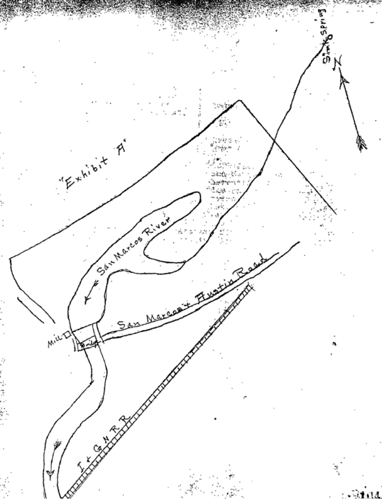
“Hmmm,” I hmmm’d. “There’s seems to be a spring up yonder!”
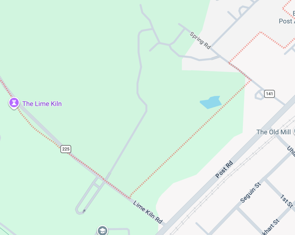
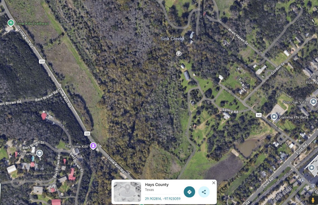
When I gawked at Google maps, I saw a road curiously named Spring Road:
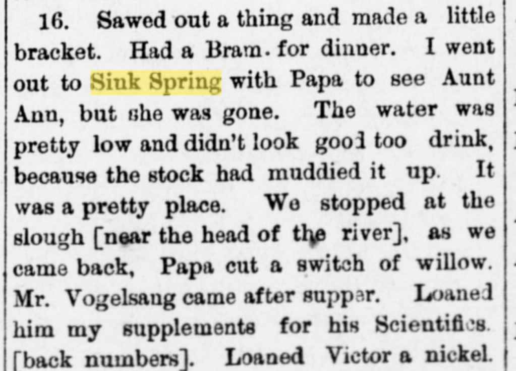
I then read reference to Ed Burleson redirecting Sink Spring to irrigate the flatlands just north of the San Marcos Springs and to a centrifugal pump later installed at Sink Springs for irrigation (Wimberley 1989).
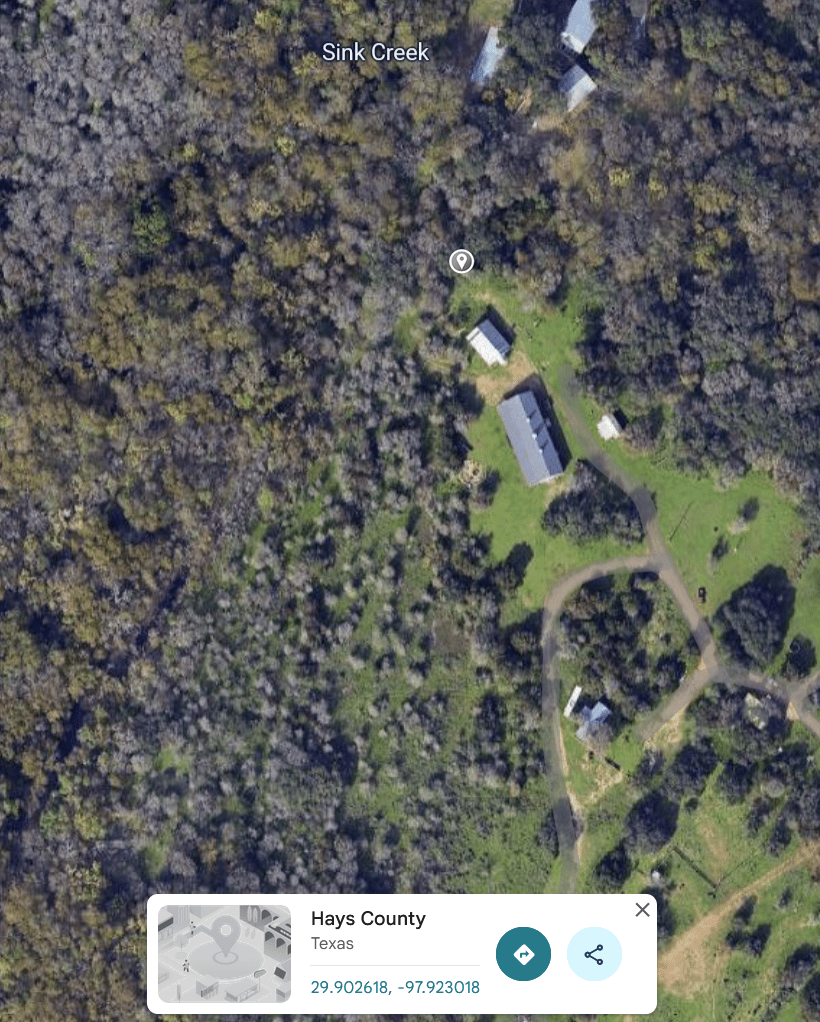
It wasn’t until I was out with a grad student, Ricardo Briones, touring rainwater harvesting systems in March of 2023 that I remembered wanting to stop to see if there was a spring down Spring Road as we drove down Post Road back to the Meadows Center. We were surprised by a historic marker for the springs:
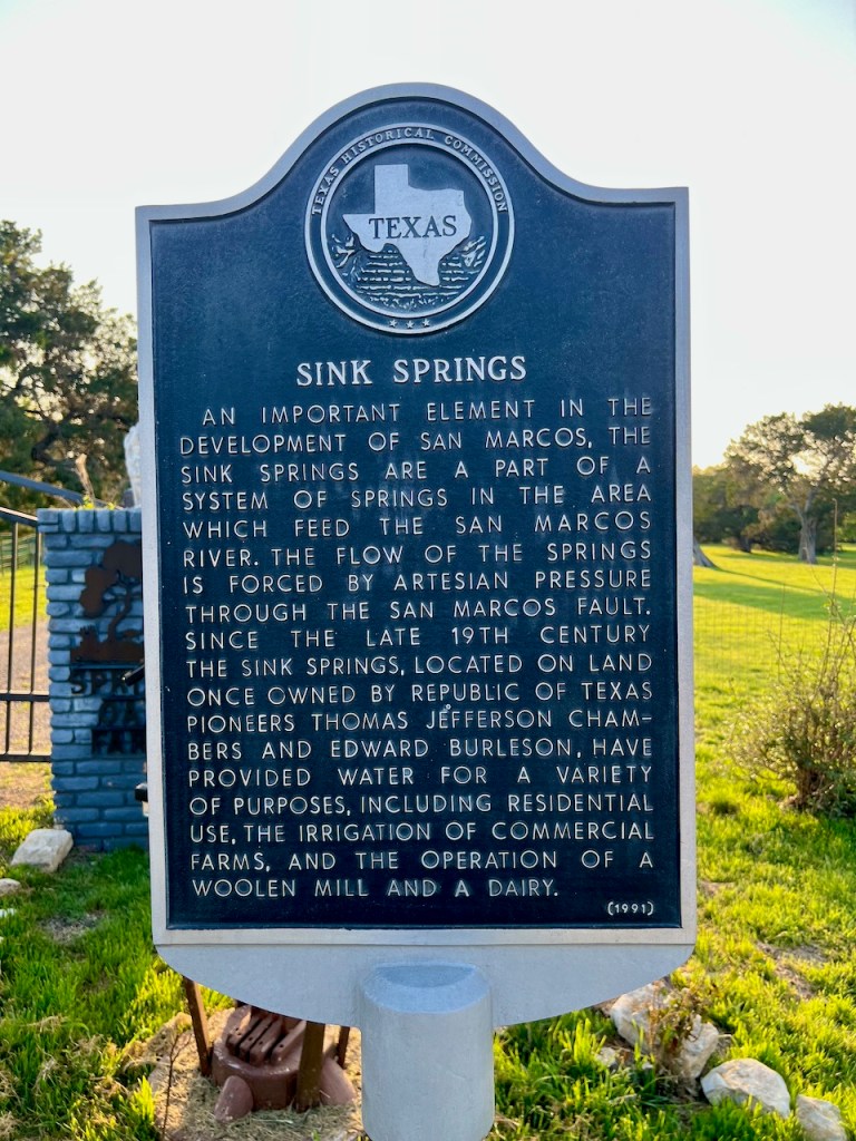
As we goobered at the sign and gawked over the fence to see if we could see the spring, a floppy-hatted dude in a pick-up truck stopped to inquire what we were up to. We learned that the marker was nowhere near the spring, which was back in the woods near Sink Creek. “I tell you what,” the floppy-hatted dude said. “I’ll show you the springs if we can drive to them in your electric car (I own a Pre-Madness Edition Model Y Tesla). “It’s a deal!” I said, and off we rolled, electrically.
The spring these days is really an estevelle, a karst feature that can act as a spring when aquifer levels are high and as a recharge feature when aquifer levels are low (and there’s a recharge event).
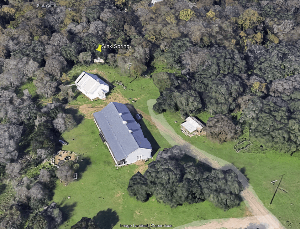
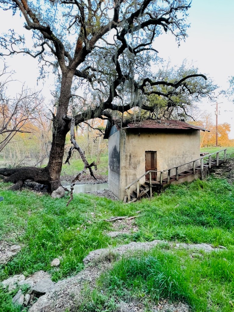
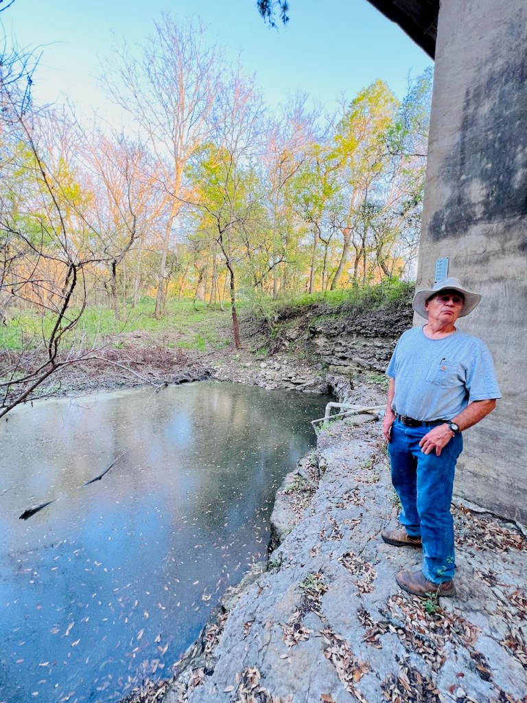
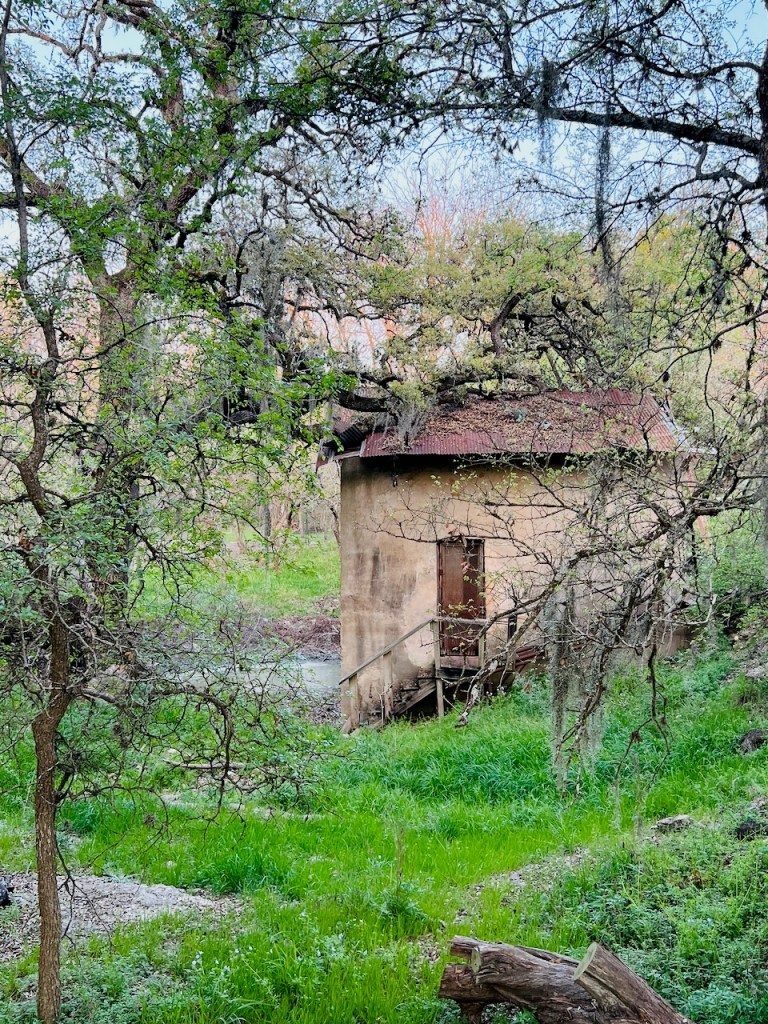
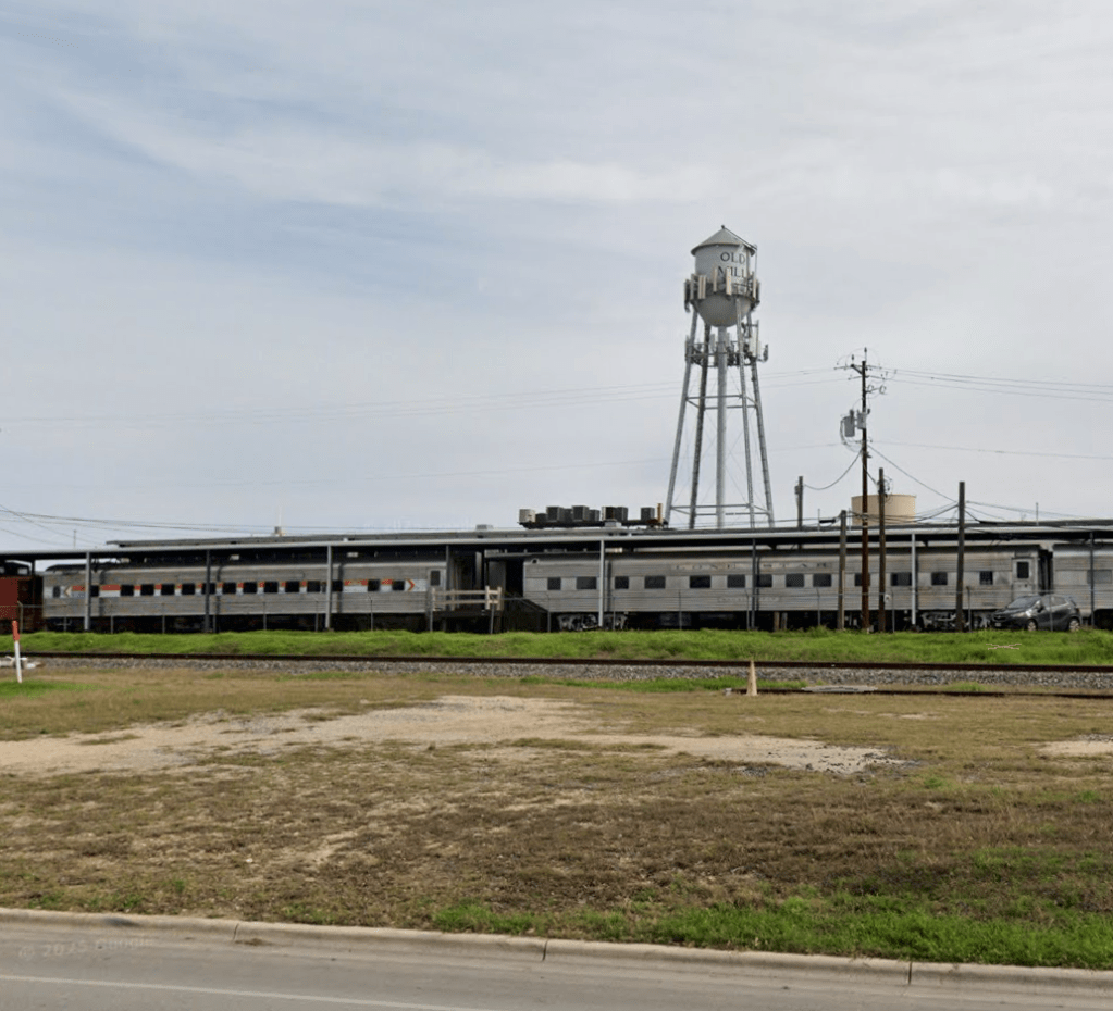
There’s an historic pumphouse at the spring with a pump in it that produces water and pipes it to a water tower on the other side of Post Road:
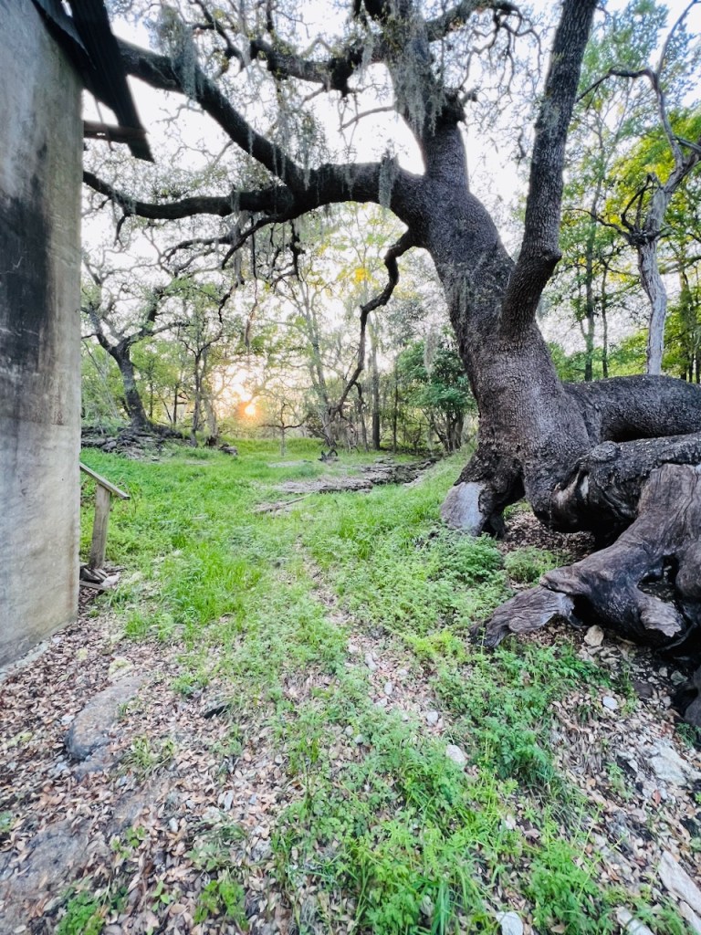
The drainage heads toward the Sink Creek, although there’s a bit of a rise to get over to flow into the creek.
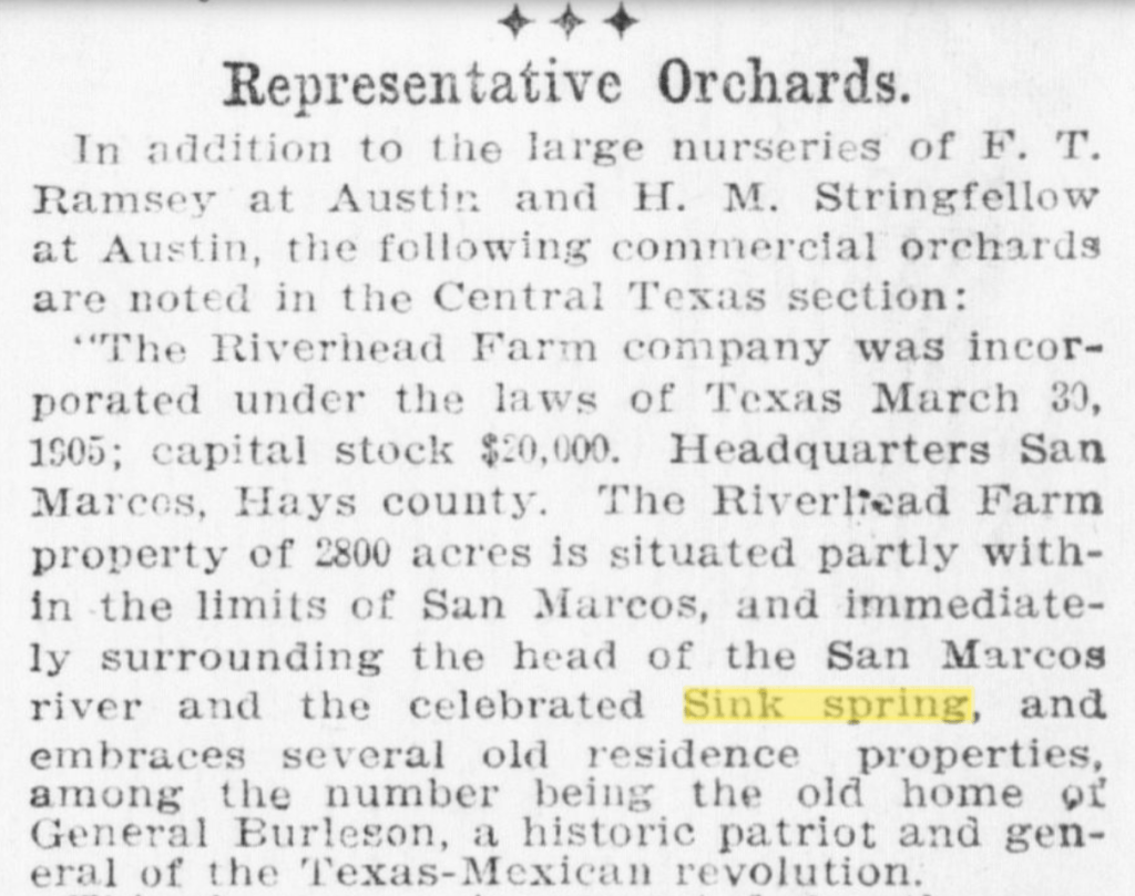
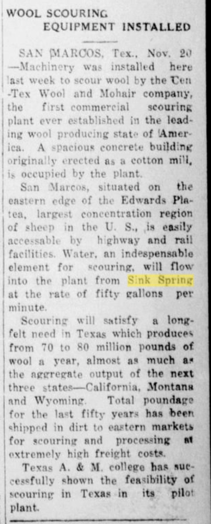
There’s not much in the scientific literature or old reports about the spring, but old state reports include the spring, although unnamed.
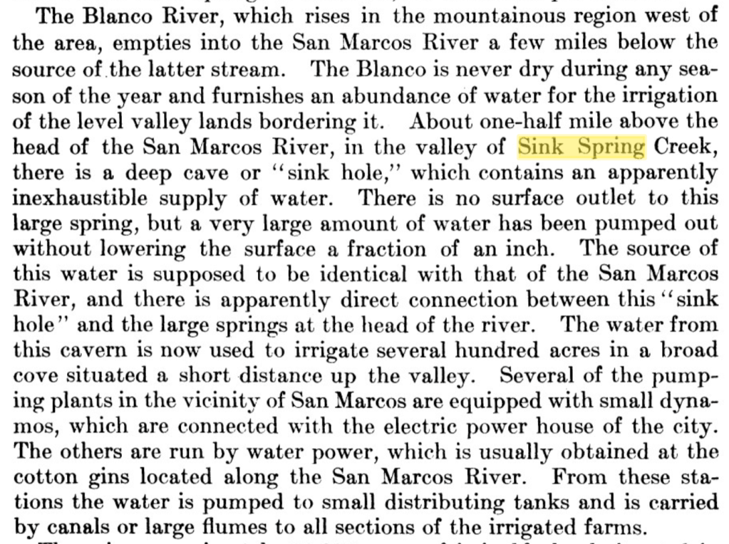
An old soil survey report mentions a sinkhole in Sink Spring Creek (Magnum and Lyman 1906):
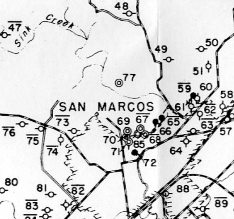
So 344 and 345 on the map below from Turner (1938) are San Marcos Springs:
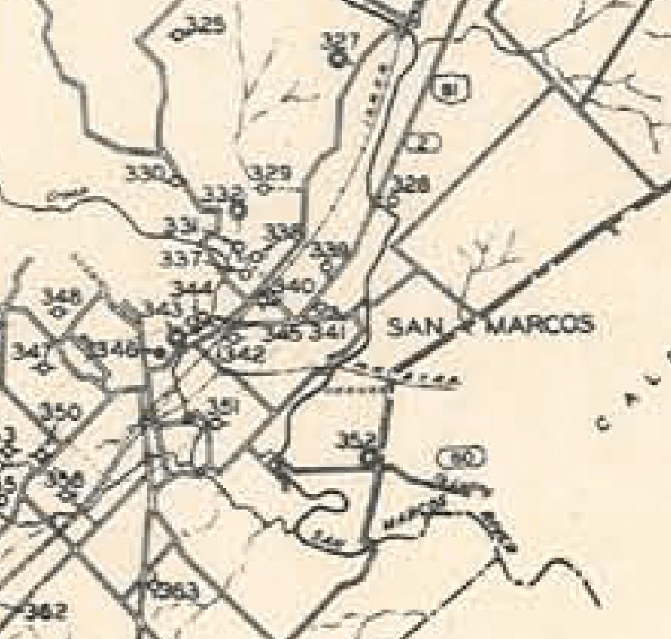
That would make 331 the location of Sink Spring with the following information in the report:
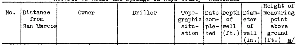

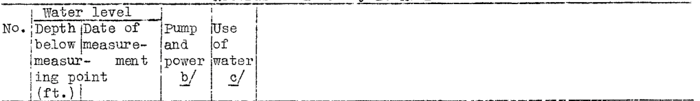

So this puppy produced 800 gallons a minute, about 2 cubic feet per second, when measured on October 4, 1937. Large-scale pumping did not take off in the Edwards Aquifer until the 1950s, so Sink Springs would not have been as affected as it is today. For example, groundwater production from the Edwards in 1937 was about 130,000 acre-feet per year whereas more recently annual production is more like 450,000 acre-feet per year (Mace 2019). It’ll be interesting to observe Sink Spring when aquifer levels are high again.
A report of springs and wells published in 1955 (DeCook and Doyel 1955) also includes Sink Springs, this time as feature H-59 (-65 and -66 are San Marcos Springs):


The nearby Rattlesnake Cave is in the Texas Water Development Board’s groundwater well database but not Sink Spring. Definitely need to fix that now that the spring is Texas State University property. But wait! There is a spring owned by W.N. Goforth that appears under the number 67-01-821 but in the wrong location for Sink Spring:
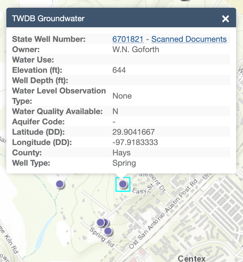
The purple dot directly to the left (west) of the hilited dot above is Rattlesnake Cave, just a concrete block’s throw north of Sink Spring. The Board’s information sources from the U.S. Geological Survey’s information, which is, indeed, Sink Spring based on the noted 800 gallons per minute measurement/estimate made of its flow in 1937.

Sink Spring doesn’t warrant much mention in the press beyond what I found above. In the aughts and teens of the 1900s, there was a race horse named Sink Spring that made the San Antonio (and Dallas and El Paso) newspapers for a few seasons. No word if that horse had flow or not.
REFERENCES
Mace, R.E., 2019, The use of water from the Edwards Aquifers, Texas, in Sharp, J.M., Jr., Green, R.T., and Schindel, G.M., eds., The Edwards Aquifer: The Past, Present, and Future of a Vital Water Resource: Geological Society of America Memoir 215, p. 207–212.
Magnum, A.W., and Lyman, W.S., 1906, Soil survey of the San Marcos area, Texas: Bureau of Soils, U.S. Department of Agriculture, 39 p.
McGehee, A., 1982, A River Reflects on Pepper’s Past: Fact, Lore, Legend about the San Marcos River, the Mill Tract, & the Old Ice House. Pepper’s at the Falls. On file in Special Collections, Alkek Library, Southwest Texas State University, San Marcos, Texas.
Turner, S.F., 1938, Hays County–Records of wells and springs, drillers’ logs, water analyses and map showing location of wells: Texas State Board of Water Engineers, 31 p.
Wimberley, C.W., 1989, My River of Innocence: San Marcos Daily Record, September 10.
