

A graduate student (Corinne) and I are researching Las Moras Springs in Kinney County, Texas, so we daytripped there and back to gawk at the recharge zone and the springs. I had hoped that they would still be dry since I hadn’t seen them in that state before and wanted to take a closer look at the pond bottom, but it was glorious that they (like the Longhorn football program) were back (at least for the time being…).
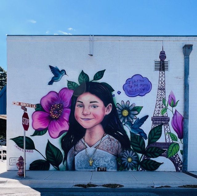
A giant (and oddly out of place) Matthew McConaughey greeted us as we drove through Uvalde on the way to the springs. We stopped to walk the murals commemorating each of the kids and teachers killed in the shooting.


After lunch at Uvalde Rexall (good!), we headed north on State Highway 55 to visit the Nueces River (Stop A in the map below) just as it crosses into the recharge zone of the Edwards Aquifer (solid blue below).

As expected, the river was flowing a healthy amount at this location. The flow at Laguna, just upstream of where we were and close to the contact between Trinity and Edwards rocks (that is, right at the beginning of the Edwards recharge zone) was about 44 cubic feet per second. The flow at Hwy 55 didn’t appear to be at that level, maybe closer to 15 to 20 cubic feet per second.


After we looped from Stop A to C to D on the map above, we paused to gawk at the Nueces River at Stop B where it crosses Highway 90. As expected, it was dry, the flows we saw at Stop A having sunk into the stream bed and the Edwards Aquifer below. This recharge heads east towards San Antonio. If water molecules from this recharge avoid agricultural and municipal pumps, they emerge at either Comal or San Marcos springs.

We also stopped at the West Nueces where it crosses Ranch Road 334. Not unexpectedly, it was dry since it’s deep into the Edwards recharge zone at this point, about 12 river miles from the Trinity-Edwards contact. According to U.S. Geological Survey streamgage data, there was about 1 cubic foot per second flowing across that contact while we gawked at acres of limestone pebbles off of RR 334. Years ago I toured this spot with the legendary Edwards geologist Bob McClay from U.S. Geological Survey along with Roberto Anaya from the Texas Water Development Board back when Roberto and I were looking at recharge processes in the area.

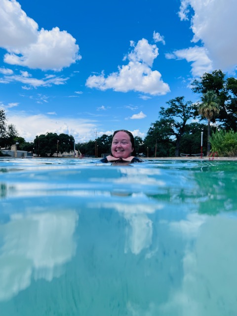
Las Moras Springs has spent much of the last year not flowing, possibly the longest spell of no-flow on record although the official record only extends back some 10 to 15 years. When we stopped in for our visit last Friday (August 30, 2024), the U.S. Geological Survey reported a flow of 10 cubic feet per second just downstream from the pools.

I dropped my BBQ thermometer at the swimming pool inlet for a temp of 77 F and probed the water with my espresso conductivity meter revealing a total dissolved solids of 198 ppm (parts per million or milligrams per liter; that be good espresso water!). That temperature is warmer than our Central Texas springs (which clock in at 72 or so) and half as salty to boot. It is warmer down here than up yonder, so a higher temperature is not a surprise, although the average annual temperature in Brackettville is about 69. The lower solids may be due to shorter exposure time to aquifer rocks. Data at the Texas Water Development Board confirms that temps are about 77 F and that total dissolved solids are in the 200 ppm range in the springs, so my culinary equipment seems legit. We then, being the dedicated water researchers that we are, fully exposed ourselves to the water by diving in to confirm the temperature. Yes, 77 feels pretty good on a hot August afternoon.


While at the springs, we had several interesting conversations with locals about where the water might be coming from, why the initial flows after the rains were green, and how drought and pumping might affect spring flows. One interesting observation was that the late July rains that brought flows back to Las Moras Springs had not, apparently, had the same effect on Mud and Pinto springs, two other springs that issue from the Edwards in the county. Interesting indeed. Hopefully someone is keeping good notes on these springs and when they come back.
After we dried off, we stopped in at the groundwater district to say hello, but it was already past beer-thirty, so we missed ’em.
After we dried off, we stopped in at the groundwater district to say hello, but it was already past beer-thirty, so we missed ’em.

Stay tuned to this blog for more posts about Las Moras Springs as Corinne and I dig through old reports and archives and gawk at the data to add our voices to the discussion on how these springs work and how pumping may affect them.
Texas Monthly story about the springs going dry

Hey, I want to go on these field trips!
LikeLike
Are you back on town?
LikeLike